DirectoryENG
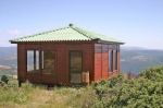
Description: this miradouro has a magnificent view to the landscape. A small observatory gives the support necessary to hold information to the visitors – Biospot or Biodiversity point. This miradouro is built on a outcrop of bedrock so that the arqueological findings that exist nearby are not damaged. For those who enjoy Lepidoptera (butterflies and moths) this is a excellent area to observe various types of species of butterflies that come here to reproduce – hill-topping.
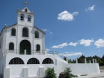
Description: At the highest point of mount Serra da Nogueira is a place known to be one of Europe’s largest extents of Quercus pirenaica. There we find the sanctuary called Senhora da Serra, mentioned in the 16th century as one of the largest religious pilgrimage of the region that between the 30th of August and the 8th of September attracts thousands of people. Some stay over night. This religious aspect also is linked to gastronomic and ludic aspects. Towards the soul side near the fountain named Fonte dos milagres (fountain of miracles) is the a certain rock called Fraga da Senhora wich shows a print similar to a horse shoe mark.
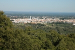
Description: Located south of the city of Bragança, known as Cabeço de S. Bartolomeu, was built a sanctuary with the same name in honour of S. Bento. This is a place with a magnificent view over the city, especially the cidadela (village with in the castle walls). Some recent pre-historic pottery fragments were found near the temple which indicates that a fortified settlement must have existed there once.

Description: Open all year round, the place is prepared with a zone for caravans. It is located near the public swimming pools and tennis courts.
Time: Open all year

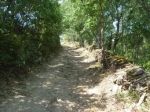
Description: This is a small pedestrian passage (PR) that crosses the territory of Pinheiro Novo. With and extension 12Km, with altitudes understood between 830m and 1149m and a moderate to high level of difficulty and corresponding about 5 hours of walking.
Starting point: Pinheiro Novo
Arriving Point: Pinheiro Novo
Extension: approximately 12km
Level of difficulty: moderate
Time: 5 hours
Description: This is a small pedestrian path of (PR) passing thru agricultural landscape of the Vinhais territory. It presents an extension of 4,8km with altitudes understood between 610m and 720m and an average level of difficulty, corresponding about 2 hours of walking.
Starting point: Vinhais (coordinates GPS)
Arriving Point: Vinhais
Extension: approximately 4,8km
Level of difficulty: moderate
Time: 2hours
Description: The Ciradelha Path, is a small pedestrian route (PR) of pleasant landscapes that goes along agricultural trails thru the territory of Vinhais. It has an extension of 9km with altitudes understood between 650m and 1000m and an average level of difficulty, corresponding about 3 hours and 30 minutes of walking.
Starting point: Vinhais (coordinates GPS)
Arriving Point: Vinhais
Extension: approximately 9km
Level of difficulty: moderate
Time: 3hours 30 minuts
Description: The Via Augusta XVII century path in the territory of Vinhais comprehends about 18 km initiating at the limit of the village of Agrochão. Here you can visit the Ethnographic Museum of Agriculture, and also the Olive Oil Museum, located in an old olive oil production unit (lagar), where the visitor takes knowledge of the process of manufacture of this ancient alimentary condiment.
Starting point: limit of the village of Agrochão passing south of the Cabeço de Marco
Arriving Point:village of Agrochão
Extension: approximately 18km
Level of difficulty: moderate
Time: 5hours 30 minutes
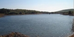
Starting point: Biological park of Vinhais (41,858758, – 6,987669)
Arriving Point: Biological park of Vinhais
Extension: approximately 6,5km
Level of difficulty: moderate
Time: 2 hours 30 minutes
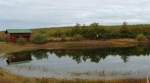
Starting point: Biological park of Vinhais (41,858758, – 6,987669)
Arriving Point: Vidoeira pond (41,864991, – 6,990438)
Extension: approximately 1,1km
Level of difficulty: easy
Time: 1 hour 30 minuts